

HIGH-ALTITUDE BALLOONING 101
STEP 6 – CHASE & RECOVERY
THE CHASE
Right after launch, we check to make sure the data on the Mission Control page is updating correctly (every 1 minute). We also monitor the ascent rate to see if it matches what we were aiming for. If the balloon is rising faster or slower than intended, that may alter our expected landing area.
After tearing down the launch site and packing up our equipment, it is time to begin chasing the balloon. The balloon usually ascends to altitudes of 90,000–100,000 ft above sea level, into the stratosphere and above 99% of Earth’s atmospheric mass. At these altitudes, the sky above is black and the view toward the horizon extends for almost 400 miles in every direction. During its ascent, the balloon passes through the jet stream, a layer of strong winds between 30,000 and 50,000 feet. The jet stream sort of acts like a conveyor belt to move large storm systems across the country, generally from west to east, and its strength on launch day is often the determining factor in how far the balloon will travel. Higher up in the stratosphere, the payload items are exposed to high levels of cosmic and solar radiation, extremely low air pressures, and very low temperatures. As it rises, the latex balloon expands in size due to the lower ambient air pressure at higher altitudes and eventually bursts once it reaches its maximum diameter (usually about 30 feet). Depending on the ascent rate and burst altitude, the total ascent time is typically 60–100 minutes.
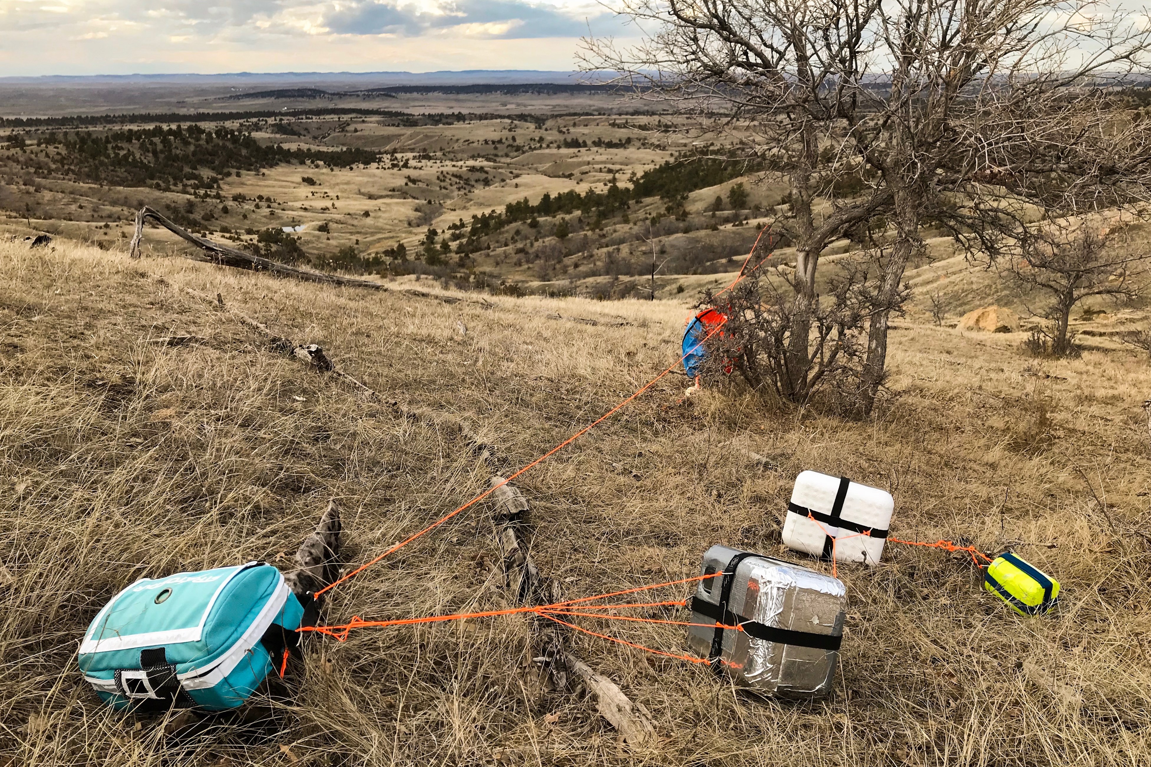
Based on how far away the payload train is expected to land, we may not have to leave the launch site immediately. However, we always try to be well on our way to the expected landing area by the time the balloon bursts, while still maintaining an internet connection so we can continue to monitor the position of the SatCom. The balloon may be visible to the naked eye all the way up to its burst altitude, especially if skies are clear. Following burst, the payload train descends rapidly at first but gradually slows down as the parachute encounters the higher air density lower in the atmosphere. The entire descent usually lasts 20–40 minutes.
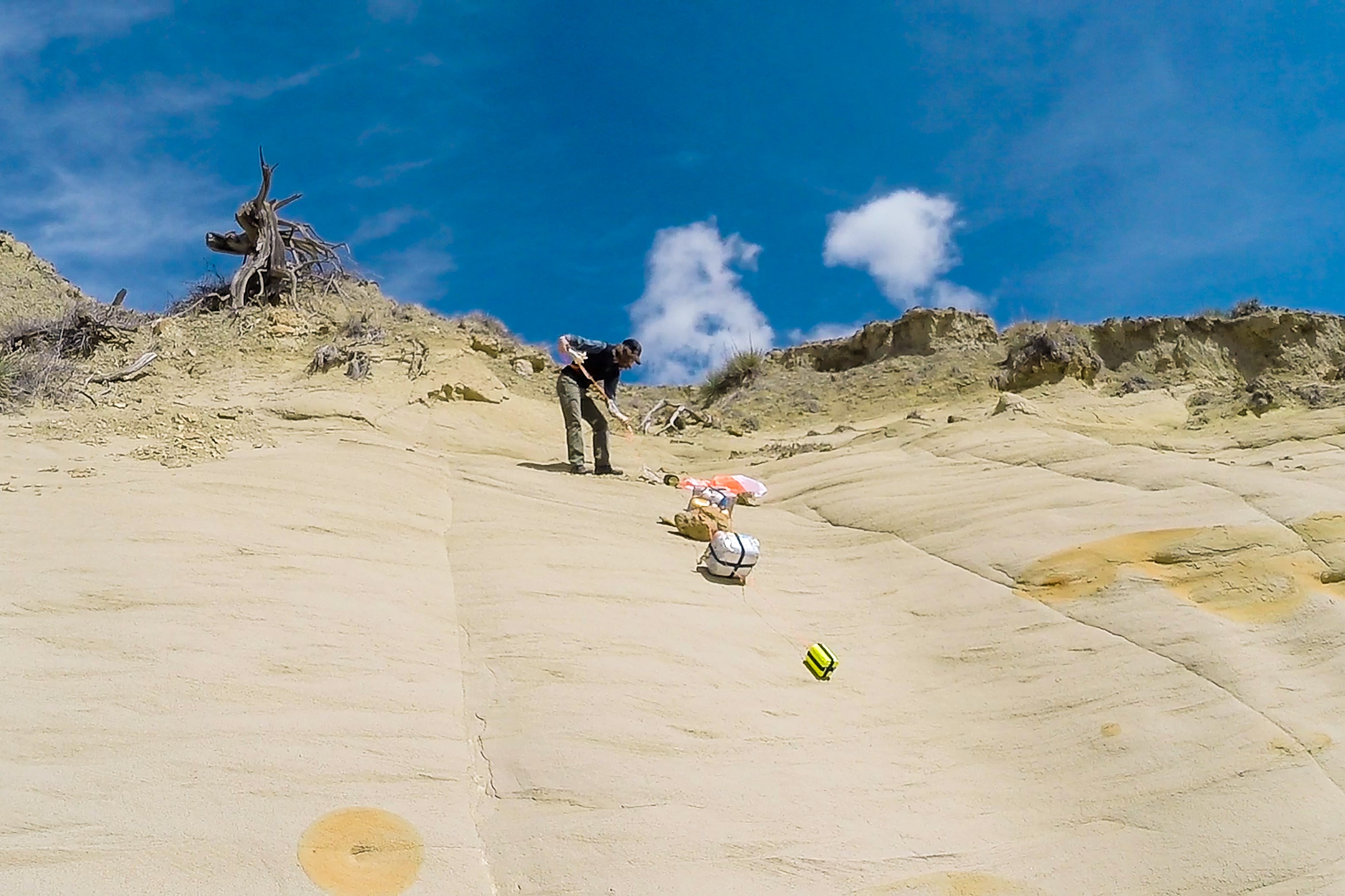
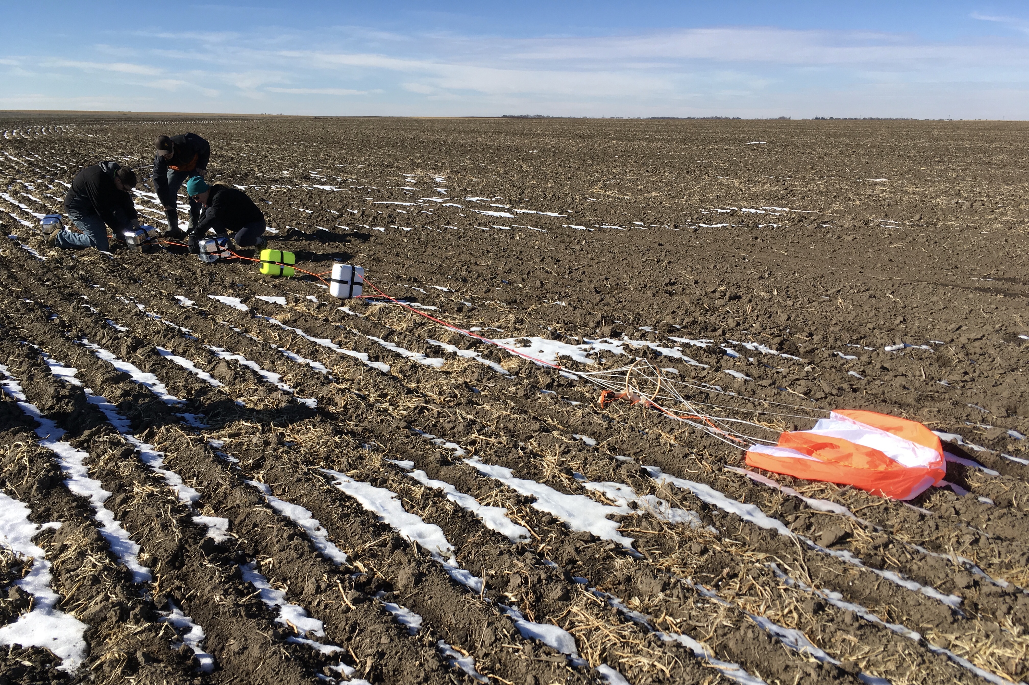
Once the payload train has landed, we consult our maps to figure out the quickest and easiest way to reach it. The better the road network, the easier the recovery (usually). Google Maps is trustworthy in most situations, although it sometimes directs us down dirt roads that either don’t actually exist or are on private property. Most of the time, we are able to plot a course that brings us to within a mile or less of the payload by vehicle.
THE RECOVERY
About 25% of our recoveries have been on public land (usually either BLM or National Forest). The majority, however, are on private property. If the payload train falls on public land, the recovery tends to be quite straightforward. We drive as close as we safely and legally can and then hike the rest of the way. Access is typically not an issue unless the only way to get to the public land is through private property. Furthermore, public roads can sometimes be unexpectedly closed or impassable (due to snow, washouts, mud, etc.).
If the payload train lands on private property, access becomes more of an issue. We always make a good faith effort to contact landowners. Most of the time, the landowner is willing to grant us permission to go on their property and retrieve the payload train ourselves. In some instances, the landowner may decide to join us for the recovery, or instead retrieve it for us.
Once we determine who owns the land, finding their contact information is not always trivial. Even if we do, landowners are not always very responsive. In rare instances, we are unable to find any contact information. When this happens, we have found that it is sometimes helpful to reach out to neighboring property owners for help. They can often point us in the right direction or provide us with the information we need to get in touch with the landowner.
Most recoveries require at least a short hike (less than 1 mile). In fact, a few of our payload trains have landed on or right next to a public road, requiring no hike at all. That said, we’ve also had several recoveries requiring lengthy hikes in more remote areas. For example, we once had to hike 12 miles roundtrip to recover a payload train when it landed deep in the mountains southeast of Casper, WY. We do our best to avoid situations like that.
WHAT EDUCATORS NEED TO KNOW
- Payload recoveries are often an all-day excursion. For a 9:00am launch, the payload train doesn’t usually land until 11:00–11:30am and typically is not recovered until early-mid afternoon. Depending on distance traveled and landing area accessibility, recovery can sometimes take even longer.
- If only adults will be joining us on recovery, we may have room for them to ride in our chase vehicle. Check with us prior to the launch to see if this is a possibility. If students will be joining us, they must ride in a separate vehicle with a chaperone.
- Anyone going on recovery who needs to be back to the school by a certain time (e.g., school dismissal) should ride a separate vehicle. A turnaround time can be determined and if we recover the payload before then, great! Otherwise, that vehicle can head back to school at the turnaround time and the rest of us will continue with the recovery efforts.
- Everyone going on the recovery should wear clothing and footwear that is appropriate for the weather that day. Be prepared for a potential hike. Do not wear sandals or other open-toed shoes. Even on warmer days, we recommend everyone bring extra layers or a light jacket.
- Finally, make sure to have plenty of water and snacks (or even a packed lunch!) in case the recovery takes longer than expected.